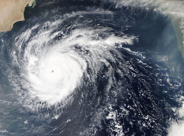
The Atlantic hurricane season runs from June to the end of November every year, when sea temperatures in the Tropical Atlantic reach 27 degrees celsius or above, providing sufficient energy for hurricanes to develop. In May 2024 the National Oceanic and Atmospheric Administration (NOAA) predicted a 90% chance that this year’s Atlantic hurricane season would be “above normal” due to warmer than average ocean and atmospheric temperatures.
The NOAA would be proven correct, a total of 15 hurricanes developed along the Gulf Coast this summer, with multiple breaking long-standing records.
This article will look at 3 hurricanes that had devastating impacts this year and explore whether climate change can be attributed to their unusual natures.
Hurricane Beryl
Beryl kicked off the hurricane season incredibly early, making landfall in the Caribbean on the 1st of July. It is now the earliest category five hurricane on record. Hurricane Beryl’s death toll exceeded 50 people across the Caribbean and Southern States. With maximum wind speeds of 160 mph Beryl was an extremely destructive storm resulting in thousands of people being made homeless.
The waters in Beryl’s path were between 29 and 30 degrees celsius, allowing for an extremely powerful storm to develop. These temperatures are not usually experienced until peak hurricane season (September).
Beryl also strengthened unusually quickly, taking only 42 hours to go from a tropical depression (with wind speeds of 38 mph) to a major hurricane (111 mph winds or higher). In climate science this phenomenon is known as “rapid intensification;” where wind speeds increase extremely quickly, giving communities in the hurricane’s path very little time to prepare.
Beryl set the precedent for what was to be a dangerously active hurricane season.
Hurricane Helene
Helene made landfall in Florida’s Big Bend area as a category 4 hurricane, and would cover a path of 500 miles in just 48 hours. Helene’s death toll reached a staggering 230, making it the deadliest US hurricane since Katrina in 2005.
Helene caused widespread damage to transport and communications infrastructure, making rescue efforts incredibly difficult, and slowing down the deliveries of emergency supplies. The hurricane caused a record breaking 16ft storm surge in Perry, Florida. Rainfall was extremely heavy, with Augusta, Georgia receiving 4 months of rainfall in just 48 hours.
The unusually high heat content of water in the Gulf of Mexico contributed significantly to Helene’s rapid intensification and the historic flooding that occurred during and after the storm. Officials have described Helene as having wreaked “biblical devastation.”
Hurricane Milton
Milton made landfall as a category 3 hurricane near Siesta Key, Florida, delivering a lethal storm surge, torrential rain and triggered multiple tornadoes. The storm is responsible for 24 deaths across the state of Florida, and has caused an estimated $50 billion in damages.
The hurricane hit Florida only a fortnight after Helene, making it the third to hit Florida this year. It was also the third most rapidly intensifying Atlantic Hurricane on record according to NOAA. A storm surge with a height of 6ft hit Naples, Florida causing major power outages. The destructive storm is attributed with having contaminated the drinking water supplies of over 200 000 people.
According to the World Weather Attribution Group, Milton’s winds were made 10% stronger due to anthropogenic climate change, likewise rainfall volume was increased by 20-30%.
Climate change and its effect on hurricanes
According to the Intergovernmental Panel on Climate Change (IPCC), climate change has increased the observed precipitation and storm surges associated with hurricanes. It is likely that the proportion of hurricanes that reach categories 4 or 5 will increase in the future.
Rising global temperatures have affected tropical storms in multiple ways:
- Warmer oceans provide storms more energy, causing high wind speeds. Record sea surface temperatures were a key reason why US scientists predicted this year’s above-normal season.
- A warmer atmosphere can hold more water, resulting in more intense rainfall.
- Rising sea levels makes the risks of flooding from storm surges more serious.
Overall, as unprecedented as some of the hurricanes in the Atlantic this season were, they very much align with the kinds of extremes we expect under the influence of Climate Change. As the planet warms, we are essentially stacking the deck against ourselves, making disasters such as Beryl, Helene and Milton not only possible, but more likely. However, reducing our emissions can change this story.


